ECOSIGG Webinar – The Development of a Terrain Model Within the Ground Model Workflow
24 July, 2024
1230 – 1330hrs BST | This webinar is FREE to attend, but booking is essential.
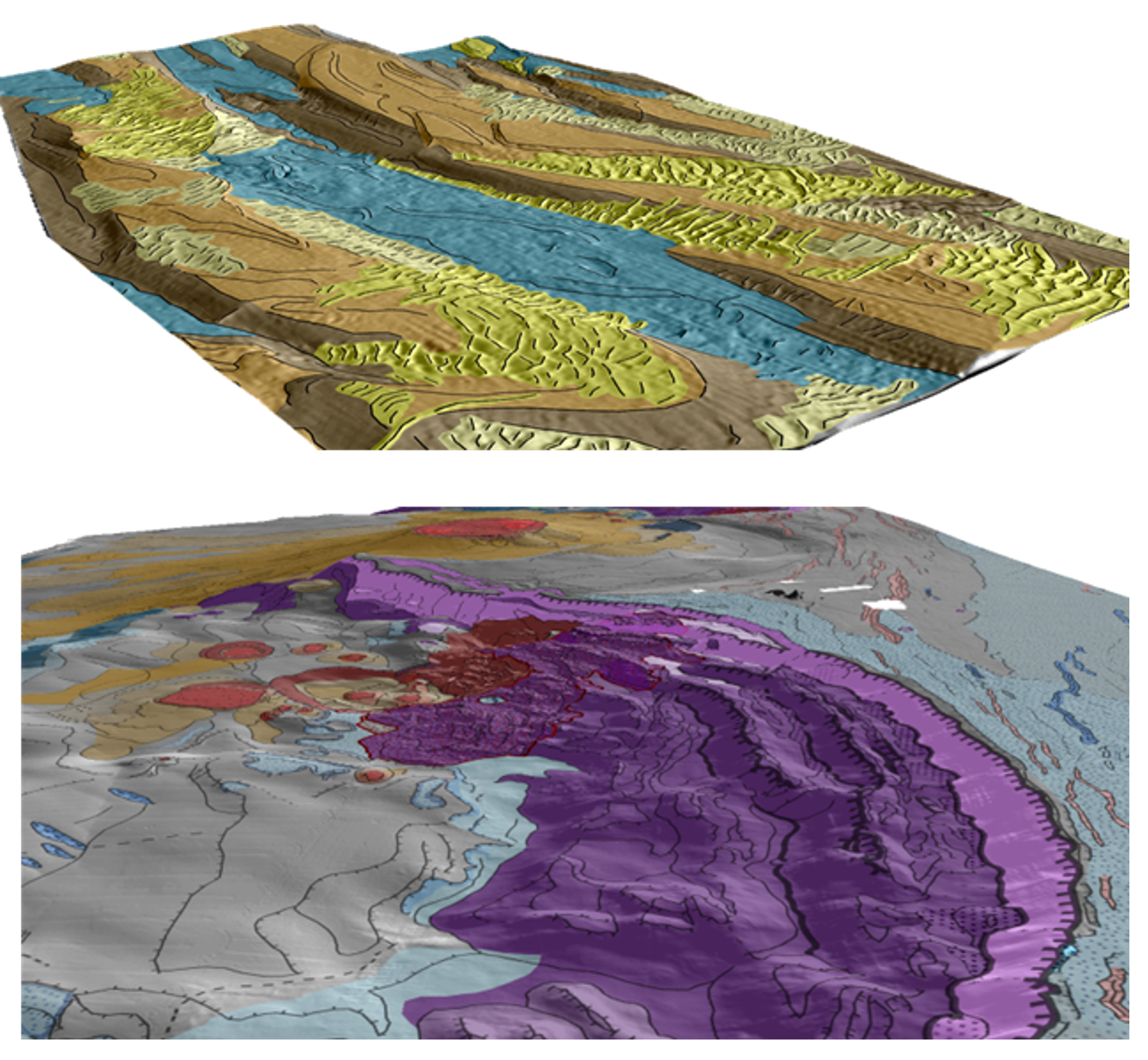 A Terrain Model is a means of providing an initial site zonation based on the geomorphological interpretation of seabed terrain. Terrain Models are created through the interpretation of bathymetry data and are integrated with geophysical, geological and geotechnical data to produce an integrated ground model. In contrast to seabed feature maps commonly provided by survey contractors, a geomorphological Terrain Model defines areas of similar geomorphology and shallow ground conditions based on the processes that shaped them.
This talk will demonstrate the process of constructing a Terrain Model and showcase examples of Terrain Models in different offshore settings. Terrain Models are differentiated from seabed feature maps typically provided by survey contractors, by their ability to delineate.
 Dr Melanie Froude BSc, MSc, PhD, FGS, Consultant Geomorphologist, EPG, OWC UK
Melanie works as a Geomorphologist evaluating ground conditions through geomorphological mapping in a range of onshore and offshore environments. Melanie holds a PhD in the sedimentology and dynamics of lahars on Montserrat, Caribbean, and worked as a postdoctoral researcher in academia on a range of landslide projects before joining OWC as a consultant geomorphologist.